malaysia 1 600 000 1 900 000
Модель:
RUR 548
Explore Malaysia with this Freytag&Berndt double-sided road map. The best way to plan your trip, prepare your itinerary, and to travel independently in this country. Place name index. Touristic information: places of interest, airports, national parks, beaches, diving, lighthouses, World Heritage sites, religious buildings. The legend is in English, French, German, Italian, Spanish, Dutch, Slovak, Hungarian, Polish, and Czech.
Модель:
RUR 1044
his map appears in the map series world mapping project in travel expertise. Characteristic is the high-quality, clear and modern cartographic representation. Contour lines with elevation Coloured elevation levels Classified road network with distances Places of interest Detailed local index GPS-compatible With graticule
Модель:
RUR 1231
Diese Landkarte erscheint in der Landkartenserie world mapping projec bei Reise Know-How. Kennzeichnend ist die hochwertige, klare und moderne kartografische Darstellung. - Hohenlinien mit Hohenangaben - Farbige Hohenschichten - Klassifiziertes Straennetz mit Entfernungsangaben - Sehenswurdigkeiten - Ausfuhrlicher Ortsindex - GPS-Tauglichkeit durch Langen-und Breitengrade - UTM-Gitter
Модель:
RUR 937
Explore Cuba with this Freytag & Berndt road map. The best way to plan your trip, prepare your itinerary, and to travel independently in this country. Inset maps of Havana, Varadero, Santa Maria del Mar, Boca Ciega, Guanabo, Playas del Este, Cienfuegos, Camaguey, Santiago de Cuba. Place name index on the other side of the map. Touristic information: airports, car ferries, ports, railway stations, bus terminals, parking, accommodation, campgrounds, restaurants, night clubs, churches and monasteries, museums, castles, theatres, post-offices, places of interest, historical sites, national parks, beaches, spas, caves, lighthouses, mangroves. The legend is in English, Spanish, Italian, German, and French.
Модель:
RUR 937
Touristische Informationen. Ortsregister mit Postleitzahlen. Entfernungen in km.
Модель:
RUR 937
This map appears in the map series world mapping project in travel expertise. Characteristic is the high-quality, clear and modern cartographic representation. Contour lines with elevation Coloured elevation levels Classified road network with distances Places of interest Detailed local index GPS capability by longitude and latitude UTM grid

Модель:
RUR 937
Carte routiere detaillee editee par Reise Know How en 2008 qui couvre l'ensemble de la Mongolie. En encart, un index des villes. Cette carte detaillee est indechirable et impermeable.
Модель:
RUR 1423
Autokarte - Cityplane - Ortsregister mit Postleitzahlen - Entfernungen in km
Модель:
RUR 593
Explore Italy with this Freytag&Berndt double-sided road map. The best way to plan your trip, prepare your itinerary, and to travel independently in this country. Place name index and inset maps in a booklet (Ancona, Bari, Cagliari, Bozen/Bolzano, Florence, Genova, Milan, Naples, Palermo, Rome, Torino, Venice). Touristic information: airports, monasteries, castles, ruins, antique sites, accommodation, caves, mountain cabins, spas, marinas, camping sites, monuments, view points. The legend is in English, Italian, French, German, Spanish, Dutch, Czech, Polish, Slovak, and Hungarian.
Модель:
RUR 548
Explore Norway with this Freytag&Berndt double-sided road map. The best way to plan your trip, prepare your itinerary, and to travel independently in this Scandinavian country.
Модель:
RUR 548
The unique combination of maps and guide. All necessary information for a short trip. Practically, concisely and to the point. What to see and how to get there. Handy format, indestructible formula (to be published in full laminated). For the busy and appreciate the simplicity and functionality. - a convenient map of Tuscany with its rich content, conveniently for the tourist scale (1:600000), plans to Florence, Pisa (both in the scale 1:15000) and Siena (1:10,000) - property descriptions and addresses of the ten most interesting places to visit in Tuscany, detailed descriptions of the monuments of Florence, Pisa and Siena (all numbered consecutively, and the numbers marked on maps) - useful practical information: public transport, weather, phone numbers - guidance on what to eat and drink what to buy as a souvenir
Модель:
RUR 743
This map appears in the map series world mapping project in travel expertise. Characteristic is the high-quality, clear and modern cartographic representation. Contour lines with elevation Coloured elevation levels Classified road network with distances Places of interest Detailed local index GPS capability by longitude and latitude UTM grid
Модель:
RUR 1164
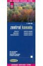
This map appears in the map series world mapping project ™ in travel expertise. Characteristic is the high-quality, clear and modern cartographic representation. Contour lines with elevation Coloured elevation levels Classified road network with distances Places of interest Detailed local index
Модель:
RUR 608
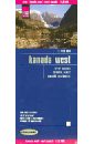
This map appears in the map series world mapping project in travel expertise. Characteristic is the high-quality, clear and modern cartographic representation. Contour lines with elevation Coloured elevation levels Classified road network with distances Places of interest Detailed local index
Модель:
RUR 1164
This map appears in the map series world mapping project ™ in travel expertise. Characteristic is the high-quality, clear and modern cartographic representation. Contour lines with elevation Coloured elevation levels Classified road network with distances Places of interest Detailed local index
Модель:
RUR 728
Diese Landkarte erscheint in der Landkartenserie world mapping projec bei Reise Know-How. Kennzeichnend ist die hochwertige, klare und moderne kartografische Darstellung. - Hohenlinien mit Hohenangaben - Farbige Hohenschichten - Klassifiziertes Straennetz mit Entfernungsangaben - Sehenswurdigkeiten - Ausfuhrlicher Ortsindex - GPS-Tauglichkeit durch Langen-und Breitengrade - UTM-Gitter